
OUR APPROACH
Science alone doesn't
save corridors.
Science plus community does.
Conservation in fragmented, human-dominated landscapes cannot be delivered through protected areas alone. The land that matters most for wildlife movement is almost entirely in private hands - owned by ranchers, farmers, developers, and families, whose decisions about what to do with that land will determine whether the corridor functions or fails.
Our approach is built on a dual foundation and one simple premise: robust science that identifies which land is critical, along with authentic community engagement to understand what truly motivates landowners.
Neither is sufficient on its own.
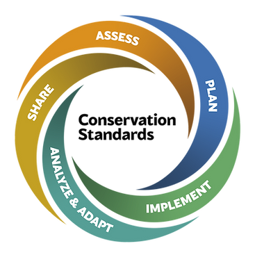
THREE INTERVENTION STRANDS
From science, to action, to adaptation.
01
STRAND 01 - PES & REFORESTATION
The landscape for conservation payments in Costa Rica is changing. Costa Rica's national payments for ecosystem services (PES) framework - one of the most successful conservation financing tools in the tropics, and a significant driver of the forest recovery this peninsula has seen since the 1980s - is in active transition. Carbon credit schemes are increasingly filling the space it leaves. Yet while payment and conservation schemes exist in this area, landowner uptake varies, and the reasons for that are specific to each property, each family, and each set of circumstances.
The opportunity is to understand what landowners in priority connectivity areas would actually need from a scheme - and to develop something locally grounded that reflects that from the ground up. Through interviews and participatory workshops with landowners in priority areas, we aim to build a detailed picture of the motivations, constraints, and incentives that drive land use decisions in Cóbano - including what healthy land, clean water, and erosion control mean to a working property, not just to a wildlife corridor. If a valid payment scheme emerges from that process, it will be shaped by what landowners told us matters to them.
Reforestation under this strand runs in parallel with the co-design process rather than following it. On each enrolled property, we first assess the degree to which natural regeneration is already occurring - this varies considerably across the landscape and determines what level of intervention, if any, is needed. Where active planting is required, species selection and planting methodology draw from experimental trials being conducted across the study area to identify the most effective restoration approach for this specific landscape. Permanent monitoring plots track recovery against a defined ecological reference state, and that data feeds directly back into our connectivity models - testing whether reforested areas are delivering the habitat quality the models predicted.
→ Read: Reforestation methodology - Our Science
02
STRAND 02 - URBAN PLANNING & REGULATORY CHANGE
Connectivity modelling identifies which parcels of land are critical to network function - but that information is only useful if it reaches the people making planning decisions. In Cóbano, the current regional planning process represents a window that will not stay open indefinitely. Once zoning decisions are made and development permissions are granted, reversing them becomes exponentially harder. The science exists now. The planning window is open now. The work is to ensure those two things meet before the window closes.
Science alone is not sufficient to change a planning framework. What it takes alongside the evidence is a demonstrated coalition of support - environmental NGOs, community organisations, and public petitions showing that the protection of high-connectivity land has broad backing across the district. A planning board responding to evidence alone can be challenged. A planning board responding to evidence backed by a unified community voice is on considerably stronger ground.
Building that coalition is as much a part of this strand as the spatial analysis. We are working to bring together the conservation organisations, community groups, and local stakeholders who share an interest in how Cóbano's land is developed - not just to add signatures to a petition, but to build a genuinely shared position on what the district should look like in twenty years. That shared position, grounded in the science and owned by the community, is what gives a regulatory framework the durability to survive changes in local government and development pressure.
The goal is a regulatory framework that identifies develop and no-develop zones based on biological connectivity value, co-designed with the planning board so that it reflects the district's own priorities. When the planning window closes, the protection will be in place, the evidence behind it published, and the community ownership broad enough to make it stick.
→ Read: Property analytics and spatial planning evidence - Our Science
03
STRAND 03 - LINEAR INFRASTRUCTURE
Roads and fencing fragment wildlife movement at exactly the points where it most needs to flow - the narrow connections between protected areas that the whole network depends on. For some species, a single poorly placed fence line or a road with no safe crossing can make an otherwise functional corridor impassable. Our science identifies which specific locations are most critical, and for which species - producing a ranked list of interventions grounded in evidence.
The interventions themselves are targeted and practical. Crossing structures are designed around the movement requirements of the species that need them - what works for a puma is not what works for a collared peccary herd, and the design reflects that. Fence modifications address the specific barrier characteristics that prevent herd movement along established routes. Roadside reforestation reduces the effective barrier width and improves conditions for species making the crossing. Each modification is small in isolation. At the right location, in the right form, the effect on corridor permeability can be significant.
Where modifications are implemented, the communities that live along those roads are part of that process from the start. What changes feel acceptable, what would feel like an imposition, what a road committee would actually agree to - these are questions answered through conversation. We aim to build relationships with road authorities, specialist organisations, and road communities at specific priority locations - working toward agreed conservation action plans that have the backing of the people who use those roads every day.
Crossing structures and fence modifications are monitored for wildlife use over time, providing empirical evidence of whether the changes are delivering what the models predicted - and informing the next round of prioritisation.
→ Read: Guild-specific road and fence analysis - Our Science
COMMUNITY AT THE CENTRE
Three community interventions.
One shared principle:
ask everyone; design as one.
WHAT SUCCESS LOOKS LIKE
Three outcomes. Concrete. Measurable.
ECOSYSTEM SERVICES
A rancher-designed payment for ecosystem services scheme operational in Cóbano - with sufficient uptake among landowners in priority connectivity areas to demonstrate measurable reversal of network deterioration, and eligible for recognition as OECMs contributing to Costa Rica's 30×30 commitments.
POLICY
A data-driven regulatory framework that protects the land parcels most critical to biological connectivity in Cóbano from unplanned development - informed by fine-scale connectivity science and adopted through a co-design process with the regional planning board.
INFRASTRUCTURE
Road structures and fencing modified at the most critical fragmentation points in the network using per species-specific design requirements, agreed with road authorities, landowners, and communities who use those roads daily, and monitored for wildlife use over time to confirm that the modifications are delivering results.
Contributing to:


